Just over twenty-five years ago, in May 1997, the Durham City Travel Study: Final Report was produced by Colin Buchanan and Partners on behalf of Durham County Council. The City of Durham Trust has published a blog posting reviewing the report and the progress (or lack of it) since then.
The Executive Summary lists the following actions to promote walking and cycling:
- developing high quality safe routes linking areas of the City
- providing “Safe Routes to Schools” and routes within the main residential areas
- improvements to the Saddler Street, North Road and New Elvet/Church St corridors
- providing more cycle parking
- encouraging local employers to provide more opportunities for cyclists and pedestrians
- new pedestrian/cyclist bridges over the River Wear
- allowing cyclists to use Prebends, Silver Street and Elvet Bridges under strict controls.
There have certainly been improvements to Saddler Street and North Road: the report recommended the introduction of the congestion charge on the peninsula, and restricting vehicle access to North Road, most of which was then still two-way. Cycle parking has been introduced, both by the council and by various employers. Of the two new bridges proposed in the report, one has been built (the Pennyferry Bridge) and the other only made sense in conjunction with an ill-advised “Park and Walk” scheme. The approaches to Prebends Bridge have been improved to make cycling easier.
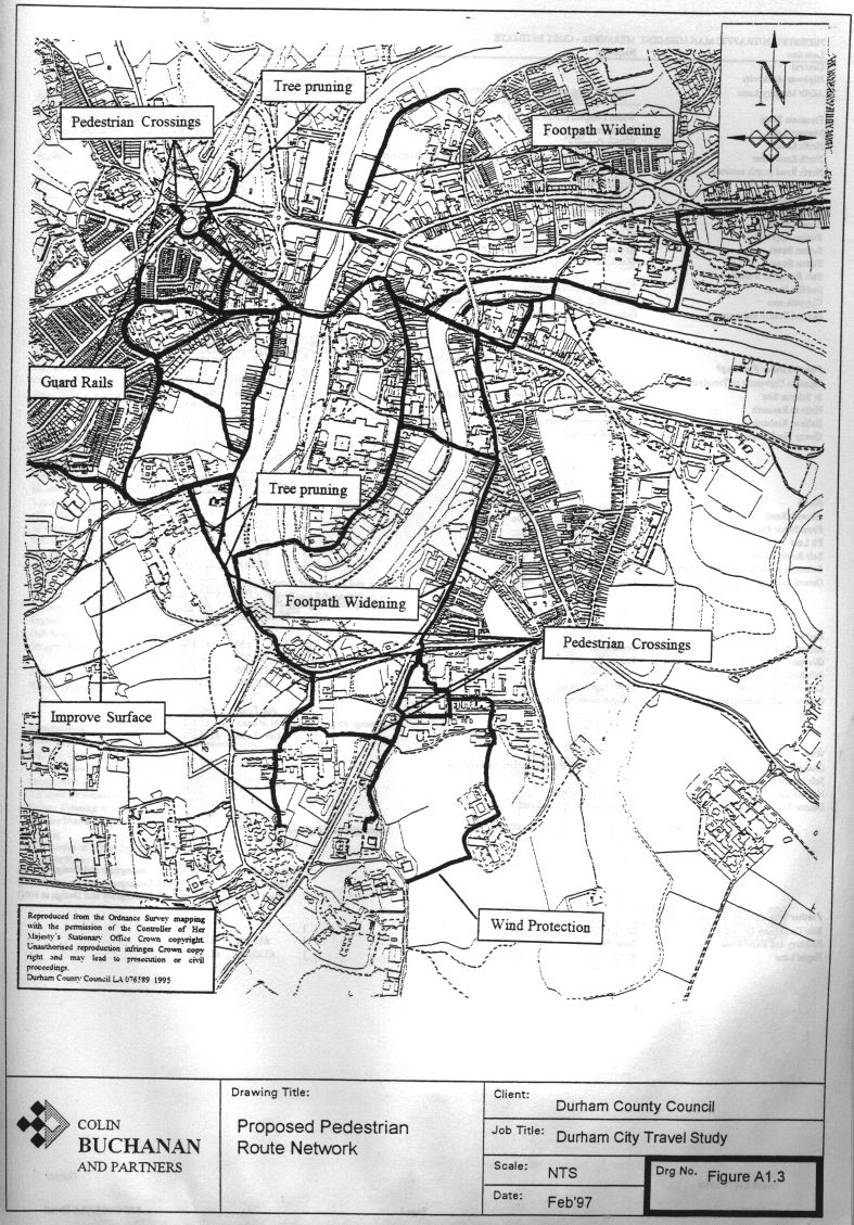
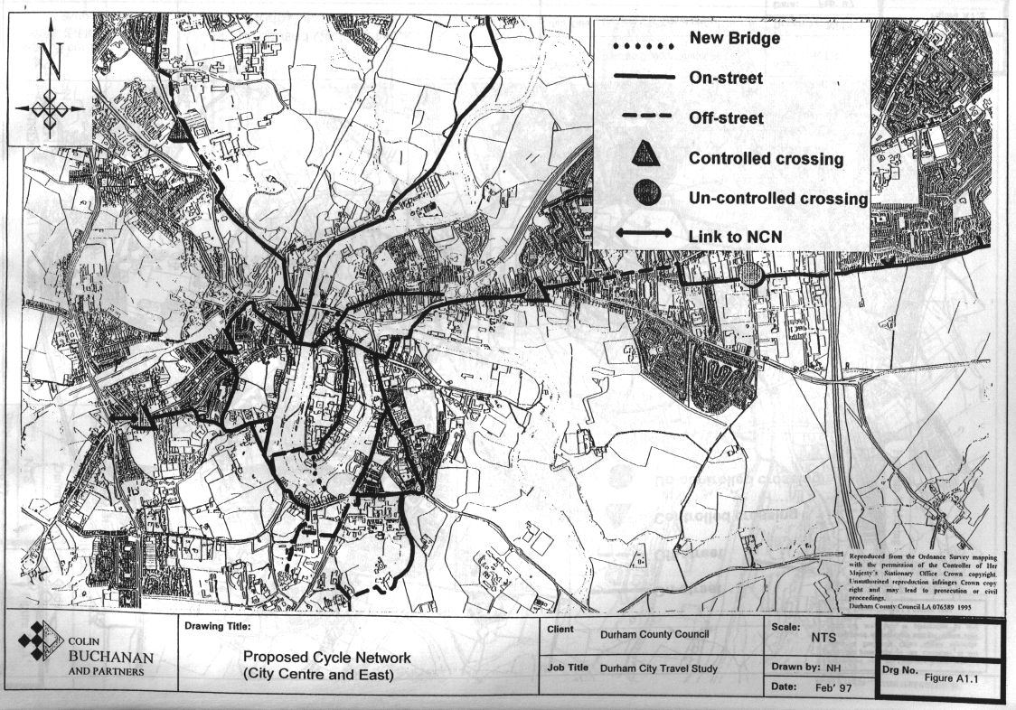
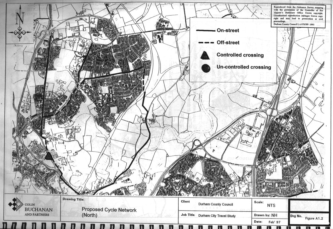
Where Durham has fallen short is in the development of the network. The achievements have mainly been isolated measures. There are currently few routes that you could describe as “high quality” whether for pedestrians or cyclists. Paragraph 5.2.2 says that “it is important to confirm the overall route structure as soon as possible to guide future traffic management and development control proposals”. The appendices of the report included three maps, but they hardly represented a coherent network.
The proposed County Plan in 2014 included a proposed cycle network, but that plan was withdrawn during the examination process. It was only last year, with the adoption of the Local Cycling and Walking Infrastructure Plan (LCWIP) for Durham City, that a route structure has really been confirmed.
How do the specific recommendations of 1997 relate to today?
New Elvet to South Road
The South Road / New Elvet / Church Street corridor was identified (in Appendix 4 section 1.3) as a location “with a high pedestrian demand but inappropriate traffic and safety conditions”. There has been some investment since 1997, but the demand is now much higher. Proposals in the report included measures to reduce vehicle speeds and improve pedestrian and cycle facilities.
Pedestrian crossings and pavements
New pedestrian crossings were proposed for crossing North Road by Station Approach, and for crossing Quarryheads Lane by the gate that leads down to Prebends Bridge. Neither crossing has been delivered and the continuing need for each was noted very recently in the Neighbourhood Plan’s pedestrian issues map. Pavements to be widened included Church Street and Quarryheads Lane. Blind Lane was to be resurfaced and extended towards Briardene: there is currently a narrow pavement only on one side of the road. A number of other proposals appear in the spreadsheet, but as they fall beyond the area covered by the map, it is difficult to work out the exact intention.
Cycle lanes
The detailed cost estimates covered on-street cycle lanes on New Elvet, Church Street and along the Stockton Road, as well as a proposal for a cycle path from Quarryheads Lane up to Trevelyan College through St Mary’s College and the Teikyo University grounds. The estimates include cycle lanes on Silver Street and Elvet Bridge, with the caveat that an experimental period of operation might be useful to get the designs right. The northern part of the city was to see cycle lanes on Front Street, Framwellgate Moor (just recently provided), Finchale Road and Pit Lane.
How long?
The 1997 report envisaged a programme of works to be delivered over five years. The obvious question, turning our attention back to the future, is how much longer will it take to deliver an adequate safe pedestrian and cycling environment in Durham? We need to confront our elected politicians with the shamefully slow progress of the last 25 years. The next generation of citizens deserves better than this!
Leave a Reply