
Southampton is not a city famous for cycling, like Cambridge, Oxford or York, but around the university there are respectable rates of cycling (for the UK) with 4% or more people cycling to work in the 2011 census, rising as high as 10% in the census area containing the main campus. By comparison Neville’s Cross and Elvet in Durham City had about 3% of people cycling to work in 2011, Newton Hall and Framwellgate Moor had 2%, and the surrounding areas generally 1%.
From a brief exploration earlier in October it seems that Southampton is doing quite a lot to make streets safer and more pleasant for people on foot and on bikes. These pictures are from the area round the university and St Denys.
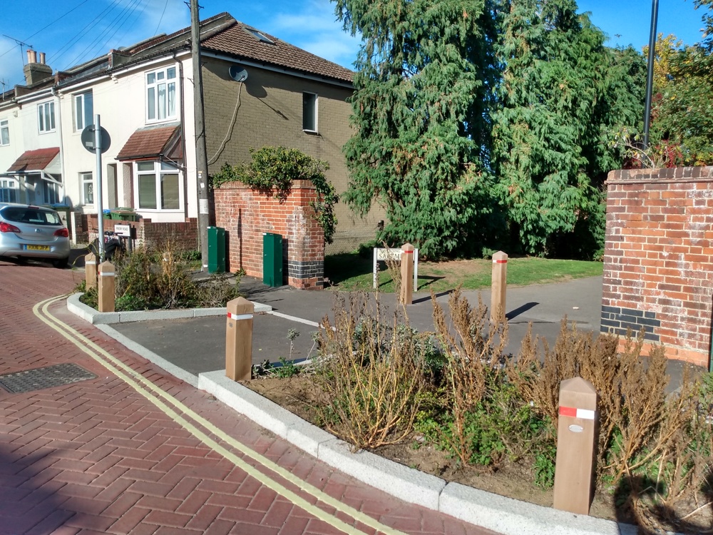
Side road treatments
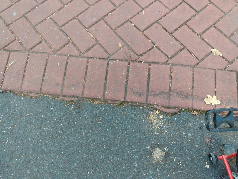
At many side roads in the area priority for pedestrians has been achieved by raising the carriageway to footway level to create continuous pavements, or by using block paving as shown above.
Actually, as you can see from the close-up, it is not actually real block paving, but a layer of coloured concrete which has been moulded to look like blocks. This is a much less expensive solution, and quicker to apply.
Recent changes to the Highway Code have explicitly stated that pedestrians should be given priority at side roads. Using engineering solutions like this reinforces the pedestrian priority. The only example we know of in Durham is near the library, where the slip road up from the A690 to Claypath passes over the pavement. This has been in place for over ten years now. Why have we not seen more examples installed?
Low traffic neighbourhoods
Just west of Cobden Bridge, which has cycle lanes in each direction, there is a street called Priory Road. Almost all the streets in this area are now subject to a 20mph speed limit.
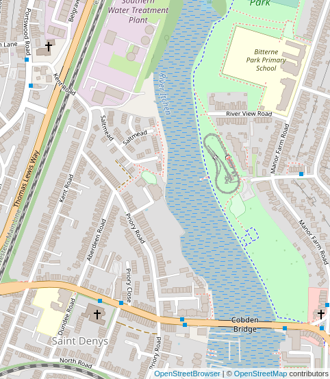
Speed limits are not the whole story. Some of the streets also used to be rat-runs for through traffic. Residents of Priory Road have particularly gained from the closure to motor traffic of the bridge under the railway line. Traffic to and from the university could take a turning off the Portswood Road, pass under Thomas Lewis Way, and reach Cobden Bridge via Priory Road, cutting off the corner and avoiding the main traffic. Even though the majority of cars would have taken the main road, enough took the rat-run to make Priory Road significantly busier than other residential streets.

The council did not only restrict access at the railway bridge, but it has installed traffic calming at some of the junctions. The built-out by the T-junction with Aberdeen Road is a very effective feature. To the right a footpath leads through to a newer street, Saltmead. The obvious route to St Denys Primary School on Dundee Road is along this path, across Priory Road, and along Aberdeen Road. This little feature adds a bit of greenery to the road, but primarily gives parents and their children a safe place to cross on the way to school, bringing them out beyond the line of parked cars to where there is good visibility.
Bus gates
Thomas Lewis Way, which runs close to the railway line between Swaythling and St Denys stations, was opened in 1989 and intended to relieve Portswood Road, the original main road through the area. In fact, the original plan was for a motorway rather than the eventual single-carriageway road. No doubt when it was first opened, the traffic on the historic route was much reduced. Increases in car ownership in the past thirty years have led to higher traffic levels, and without any restrictions on using the original route, any benefit to the Portswood Road has long since evaporated. The council now has plans to restrict through traffic on Portswood Road by the shops. Buses and bicycles would be allowed through, and the pavements would be widened. This will greatly enhance the shopping street as a focus for the local community. It should also force more traffic to use Thomas Lewis Way, and probably make the rest of the historic route quieter. Stopping up rat-runs, like the route under the railway to Priory Road, is a key part of these plans.
It is interesting to consider whether similar ideas could be applied to Durham. The A167 and the A690 were both built to relieve historic routes, which are still open to through traffic. We will come back to this idea in a future article.
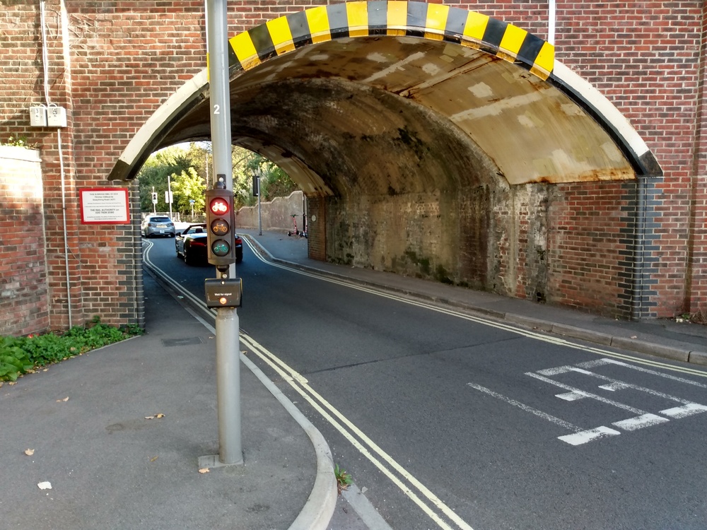
Cyclist traffic lights
The final picture shows some mini traffic lights for cyclists at the approach to a narrow bridge under the railway, near Southampton Airport on the inaccurately named Wide Lane. Traffic alternates along the narrow road under the bridge. When the cycle lights go green, cyclists have free passage through in safety while the motor traffic is stopped. This shows us that there is usually a solution to provide safe space. If the council tells us that there is no space for a cycle lane, or no room to widen the pavements, what they are really saying is that they have chosen to prioritise the motor traffic over people walking or cycling.
Mini lights like these have been generally available to councils since 2016 with the update of the Traffic Signs Regulations and General Directions, but it has long been possible to have cycle-only lights: they just had to be full size. As far as we know there are no examples of cycle-only lights, whether full size or miniature, on Durham County Council’s highways. If you know of any, please bring them to our attention via the comment form below. The only signalised facilities for cyclists are in the form of toucan crossings, where cyclists share with pedestrians.
Conclusion
It was refreshing to visit a city where the local council clearly has a strategy to improve streets for people, and create a safe pedestrian and cycling environment, with an ongoing investment programme. It would be interesting to know why we are not seeing a steady transformation of Durham. Is it our failure to win funding from central government? Have the needs not been recognised by our politicians? Are our highways engineers uncomfortable with the latest design principles? Whatever the reason, as other cities are improved, you can’t help feeling we are missing out.
Leave a Reply