
This summer, over the course of the few weeks, your correspondent made a few trips to the Dryburn hospital to visit a poorly member of the family. Travelling from central Durham it is hard to work out the best way of accessing the hospital by bike.
You can try the car route, on the A691 (Southfield Way) but it is a fast road and it does not feel very safe cycling along it. At the roundabout by the Land Registry where you turn into the hospital there are shared-use pedestrian/cycle signs on the pavement at each crossing of the arms of the roundabout, but the cycling provision bizarrely does not seem to extend beyond the roundabout in any direction. This is confirmed on the new Cycling in Durham City leaflet from the Council.
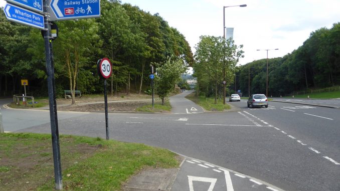
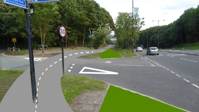
Further south on the A691, by the entrance to Aykley Heads, there is a group of cycle direction signs which includes a pointer to County Hall and the hospital. That is the last time the hospital is mentioned: if you follow the path the subsequent signs only direct you to Wharton Park and County Hall. Whichever way you take, you end up having to negotiate the County Hall roundabout, and if you have gone as far as County Hall expecting the path to continue to the hospital, you will find yourself with no path and on the wrong side of the road.
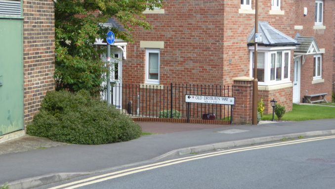
If you take the B6532 instead, there are actually officially two cycling routes through to the hospital, but neither has a dropped kerb, and neither has any signage that you would spot before you have missed the turning! Here is the first one:
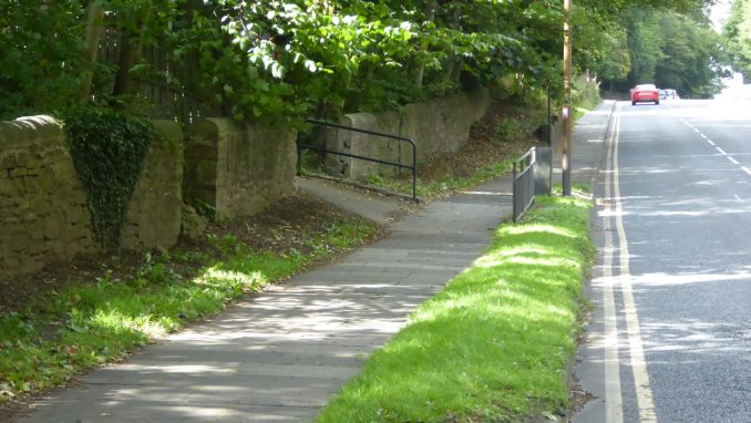
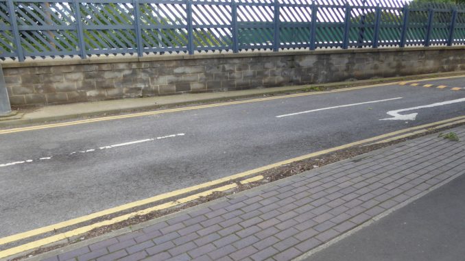
The other end of this comes out on Old Dryburn Way, where there is signage, but the placing of the dropped kerb is not ideal:
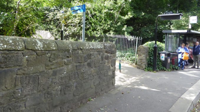
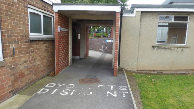
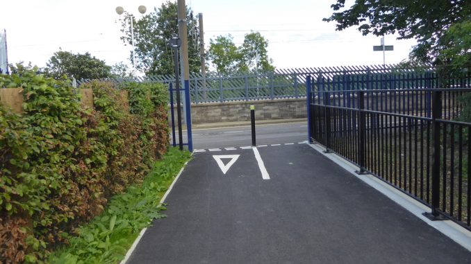
The other official cycling route is at the north end, just by the bus stop. The route is quite narrow at times and at one stage goes through an entrance to a hospital corridor, which is bizarre. Still, we can be thankful that cycling is permitted on this route, even if it is far from obvious how to reach it.
Coming in the opposite direction, of course, each of these routes abandons you on the pavement on the wrong side of the road. You could be forgiven for assuming that cyclists are permitted to use the pavement on the west side of the B6532, as there are no signs indicating the end of either access route, but it would not be wise to rely on this as there are no shared-use signs on the main road. I tended to use the Old Dryburn Way route when returning from the hospital, crossing over the B6532 to join the bus lane to the County Hall roundabout, but the route is distinctly disjointed and amateurish.
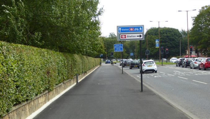
From the County Hall roundabout south to the station, the Council have recently resurfaced and improved the shared use pavement. This section used to have paving slabs, and a white line demarcating the cycling and walking halves of the pavement. Now it is nice smooth tarmac, which is much better to cycle on, but the segregation has disappeared. It is true that paint never works very well as a means of segregation: we see that equally on the roads, where painted cycle lanes are useless for protection, but can sometimes be of help in keeping the cars far enough away from the kerb to allow bikes to get past a queue of congested vehicles. What would have been ideal here would have been a stepped cycle path, as commonly used in Copenhagen, but this would have required relaying the kerb, and added considerably to the cost.
Anyhow, criticisms aside, there has been a real improvement on this route, particularly in the way that the road signs are supported. Note that there is only one post for each of the signs shown, and that each is as close to the edge of the road as possible, maximising the space for cycling and walking. Previously many of the signs were supported by two posts, and as you could not really cycle between them it had the effect of halving the available width.
Unfortunately there has not been sufficient attention to detail when it comes to the places where the path starts or finishes, or where it crosses junctions. If you are approaching from the north, the most obvious route onto the path is to proceed round the County Hall roundabout. Just at the right of the following picture, there is a dropped kerb, which also serves for the foot crossing over the approach to the roundabout:
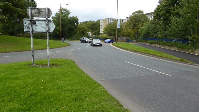
Unfortunately, despite the path being entirely resurfaced, the Council has paid insufficient attention to the dropped kerb itself. For one thing, there is no painted road marking to indicate to cyclists that a shared-use footway is available. More seriously, however, the dropped kerb stands proud of the road surface to an extent which makes it hazardous to negotiate by bicycle.
To mount the pavement without being at risk of falling off, you need to slow down, and take the kerb at an angle much closer to ninety degrees than is natural in this situation. Any car following you closely off the roundabout is very unlikely to expect such a manoeuvre, so the cyclist has to set the risk of falling off against the risk of being hit in the rear.
The next hazard is the junction at the southern entrance to the Aykley Heads site, which leads to the station car park and the former DLI Museum. Here the cycle path essentially gives up. There is a wide splayed junction to cross, which has a large radius geometry for the motor vehicles, meaning that cars do not have to slow by very much when turning off the main road.
Whereas cars on the A691 can proceed without any interruption, a cyclist on the parallel shared-use path must carefully check over the shoulder to see if any vehicles might be about to turn off (indicating or not), as well as contending with vehicles emerging from the Aykley Heads site. Admittedly this path could be a lot worse: there is only one side road between County Hall and the station. Shared-use paths often have many more side roads, and are rightly despised by cyclists: not only does it lead to a stop-start progression (which on a human-powered vehicle costs precious energy) but it is arguably often safer to be on the main carriageway where you unambiguously have the priority.
Here there is plenty of space to do a much better job, and with the Council spending large sums on earthworks to give easy access to the station, it is a shame that this junction has not been dealt with properly. Ideally, the foot and cycle way needs to be swung over away from the main road on the approach to the junction, with “give way” markings and a raised table to give pedestrian and cyclist priority across the road. There is sufficient space for a car or large van to stop safely off the A691 to give way to cyclists.
The section through to the station drive is finished to a high quality, though it will need care from users to avoid conflict, as with all shared use facilities. If the volume of users increases it will be an expensive job to widen the route sufficiently should separation of cycling and walking be needed in the future.
Sadly, just beyond the bollard, there is no dropped kerb onto the station access road. Attention to detail lacking again!
In summary, it is good to see the improvements from County Hall to the station, though with a moderate amount of additional work it could be a top quality route. It is certainly an improvement on the other excuses for infrastructure on the approach to the hospital. Fundamentally the problem around the hospital is one of incoherent, disjointed bits of half-hearted cycle route which are not going to do anything very much to encourage people to leave their cars at home and get on a bike. And sadly, often all that was needed was a bit more attention to detail.
Leave a Reply