

In October Durham County Council’s Cabinet adopted some important documents which will affect future cycling and walking investment in three of the county’s main settlements. The Department for Transport requires local authorities to have a Local Cycling and Walking Infrastructure Plan (or LCWIP) in place in order to apply for central government funding through the Cycling and Walking Investment Strategy. You can see the full documentation via the Cabinet meeting agenda for 13 October, but here are quick links to the LCWIPs which were adopted:
There are also technical documents behind the plans which we have requested from the County Council.
The plan documents are not very long. It is good to spot some of the local councillors appearing on the front cover: let us hope this is a sign that our elected representatives will push for these investments to be prioritised. It is good that the LCWIP for Durham is now in place, because the policies of the County Durham Plan, which are used to decide on planning applications, refer to the LCWIP and money from developers could be a useful source of funding for the improvements.
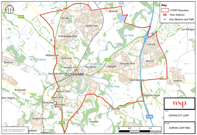
Although there was a stakeholder session in January 2020, consultation has been limited. It is a shame to see that the area covered by the LCWIP, which was criticised by several of the stakeholders, has not been expanded to cover places like Langley Moor, Meadowfield and Brandon, just to the west of the A167. These are well within cycling distance of Durham.
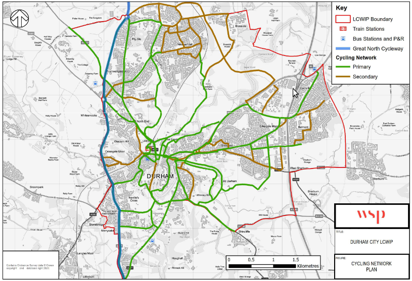
The cycle route map shows the routes which have been identified as primary (green) and secondary (brown) routes. Although it is not explained in the main LCWIP document, the technical report for Durham City categorises the secondary routes as “linking routes at a more local level”, whereas the primary routes will have “cycling provision at all junctions along route, with priority given where possible”. There is also a category of “super route” which might correspond to the blue “Great North Cycleway” on the map.
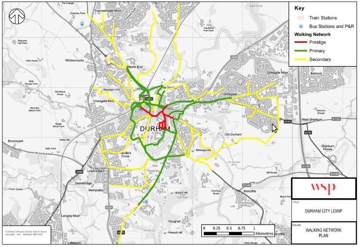
The walking infrastructure map covers a smaller area. There is, of course, already a reasonably safe walking network in the form of pavements across the whole city, so the purpose of the LCWIP is presumably to set out where improvements are most needed. It is not clear from the main LCWIP document what interventions are planned. It says “improvements to the walking infrastructure were identified and are presented in the concept plans provided in an appendix of the LCWIP Technical Report”. We have requested a copy from the Council and so we hope to be able to report further on the measures we can expect.
To judge from the proposals for the priority route (roughly South Road, New Elvet, Gilesgate and out to Broomside Lane) the changes will include raised tables at junctions, so that pedestrians have priority over turning traffic, and widening the pavements in various places. A comprehensive plan catering for all users would need to look at dropped kerb provision, width of pavements, traffic calming measures, and even issues such as lighting and drainage. There is mention of people walking and cycling sharing the space on some parts of routes. We need to be sure there really is no alternative, because shared use paths are not brilliant for cyclists or pedestrians!
We hope that the LCWIP will develop further in response to the needs of people walking and cycling round the city. We have certainly noticed a few anomalies and gaps in the proposals. If you would like to contribute to our response to the council, perhaps you could add your thoughts via the comment facility below?
Thanks for this explanation. As I understand it LCWIPs only cover part of the picture for walking and cycling. When you have time could you also explain what the Strategic Cycling and Walking Delivery Plan is? That’s the plan that might reference bike maintenance & repair facilities? If we are going to have better infrastructure and more people cycling we also need more bike shops!